See it in action
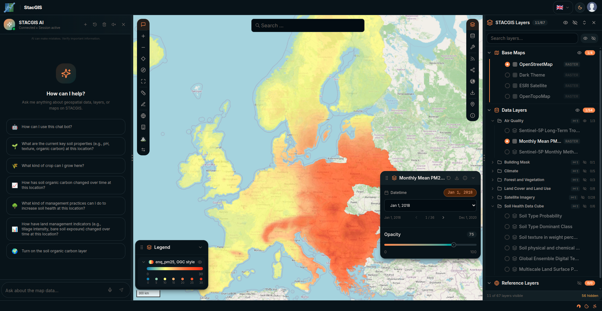
A live view of the map-centric interface — explore data cubes, ask the AI agent questions in plain language, and browse your catalog from one workspace.
Three components, one platform
Use any piece standalone — or combine them into a self-hosted, AI-powered geospatial platform.
Core
The STAC-compliant platform: FastAPI + React, PostgreSQL (PostGIS + pgvector), MinIO storage, async GIS processing — and a full map-centric application with AI chat.
Core docs →Geo-AI
A reusable harness for geospatial AI agents: ReAct loop, MCP tools, local LLMs via Ollama, FastAPI streaming, and the <AgentChat /> React component.
Catalog
A Python toolkit (stac-catalog) that turns raster metadata (CSV or Google Sheets) into STAC Collections and Items, loads them into pgSTAC, and serves them via STAC FastAPI, TiTiler, and a ready-made STAC Browser.
A pragmatic geospatial stack
Standard, boring technology where it counts — and modern, standards-based building blocks (STAC, OGC, MCP) where it matters.
Up and running in minutes
Clone Core, copy the example environment, and bring up the full stack — web apps, backend, database, cache, object storage, and the AI runtime — with Docker Compose. Point the Catalog at the STAC API and you have a complete platform.
# 1. Get the code
git clone https://codeberg.org/stac-gis/core.git
cd core

# 2. Configure
cp backend/stacgis/.env.example backend/stacgis/.env

# 3. Launch the full stack
docker compose up -d --build

# 4. (Optional) build a STAC catalog with stac-catalog
stac-catalog sync --source csv --input ./input --output ./output
Start building with STAC GIS today
An open, private, AI-powered GIS platform — ready to extend and made for your own infrastructure.